PIndar creative
Project Name: Kirkcaldy Cycle Map
Client: Greener Kirkcaldy
Sector: Towns and cities
Location: Kirkcaldy and Glenrothes (Scotland)
The role: Map design and typography
The brief: Greener Kirkcaldy is a community-led charity and community development trust working on a local scale to benefit people and the environment. Formed in 2009, their team of 20 staff, over 50 volunteers and around 500 members deliver projects to meet the needs and aspirations of local people, tackling fuel and food poverty, protecting and enjoying the environment and bringing the community together.
Following requests from residents for an up-to-date cycle map, Greener Kirkcaldy decided to commission one and secured Smarter Choices, Smarter Places funding as part of a wider walking and cycling project. The map aims to encourage more people to get out cycling, including those who are new to or returning to the activity.
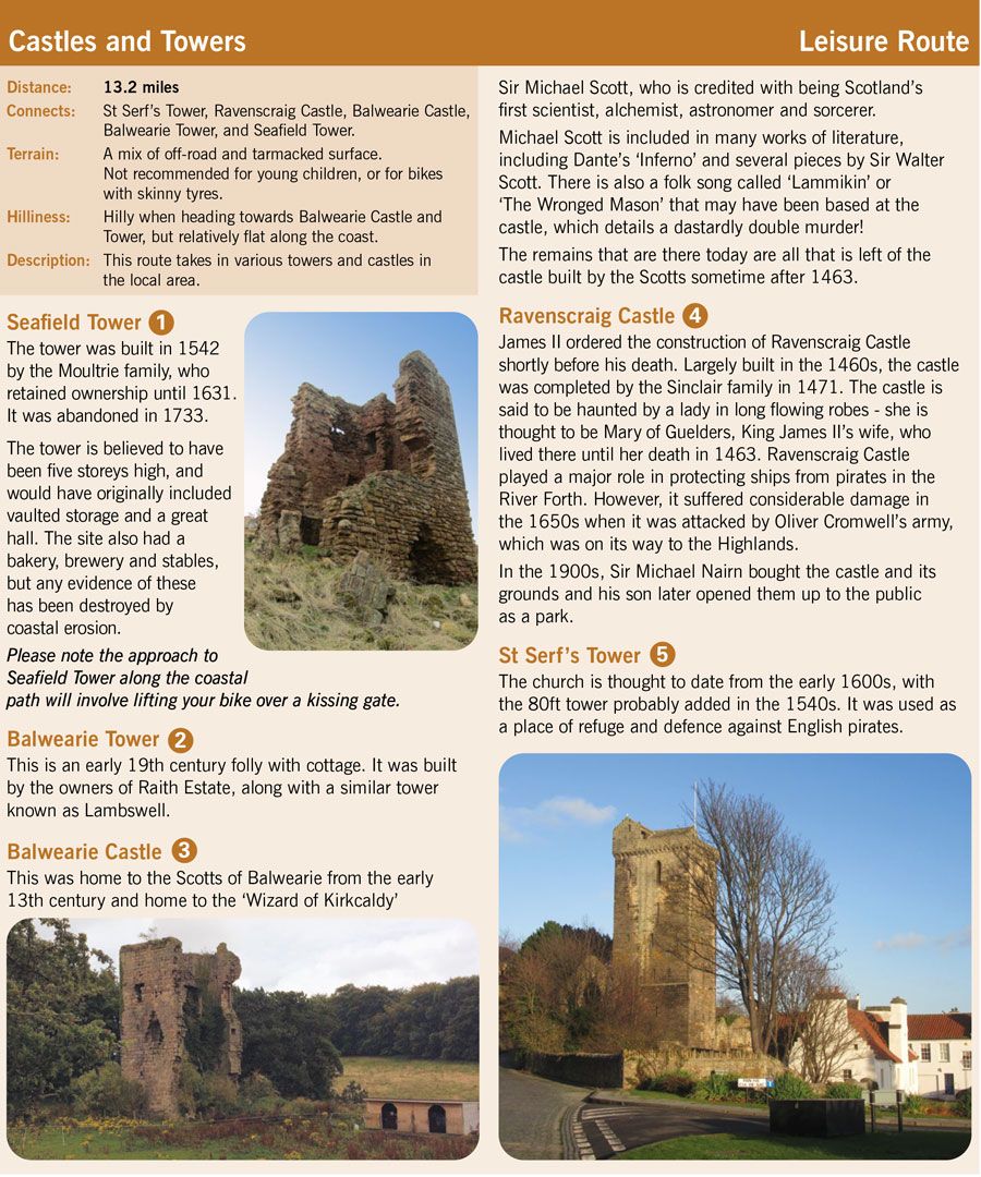
Outcome: As well as highlighting the town’s traffic-free, shared-use paths, the map shows six routes, ranging from an introductory 3.6 mile ride to a leg-stretching 13 mile leisure route exploring some of Kirkcaldy’s castles and towers. The Heritage Plaque Track was developed in conjunction with Kirkcaldy Civic Society and is a great way to discover some of the towns many historic sites by bike.
Pindar Creative was selected to create the cycle map which includes an inset map extending the coverage out to Glenrothes, a neighbouring town that a lot of people commute to. The photographs supplied by Greener Kirkcaldy highlight the town’s three main parks and the coastal path, as well as its heritage. A scale bar showing both miles and kilometres and time-distance bars help users gauge distances and travel times by bike.
Intended for both residents and visitors to the area, the guide aims to encourage people to cycle to key destinations in and around the area, or for day-to-day journeys such as commuting or shopping.
Pindar Creative’s skilled cartographers understand that legible mapping is key to encouraging novice cyclists to get out and about. Clear and precise mapping should help people make informed decisions between different modes of transport and give them confidence in the routes they choose.
Case Study Submitted by Pindar Creative (info@pindarcreative.co.uk).